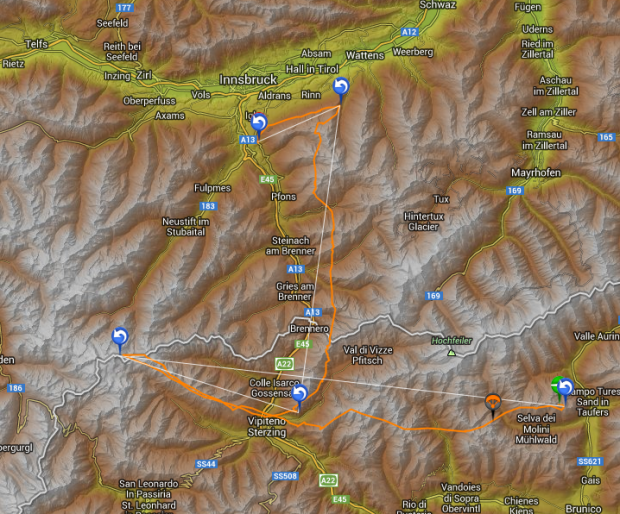
On Monday, the morning after our flight from Scuol we aired out Bruce’s reserve and got it packed back up and came up with a plan. Much of the eastern Alps were now looking possibly very good for Tuesday, even “Hammertag” good, depending on what forecast you were using. A big heat wave was moving in from North Africa which meant the air might be more stable, but with the summer solstice only a couple days away, we had very long days to work with. To me, the Pinzgau (the area near Salzburg) looked the best. But it was totally unknown to both of us and Bruce was very keen on Speikboden, a place that pilots often do monster triangles on good days that stretch into the Dolomites on their southern turnpoint and a place that had completely shut us down last year with rain. He was hungry to return. Bruce can be very convincing and in this case there was no way of talking him out of Speikboden, even though to me it seemed like the location was taking preference on weather. And Bruce follows the weather in the Alps more closely than anyone so I’m always more than happy to go where he says to go.
Speikboden was an easy 3 ½ hour drive across a bit of Austria to Innsbruck and over the Brenner pass into Italy. It was a gorgeous day, but too windy to do much with so it was a good day for relocating. We’d paid a ridiculous amount of Swiss francs the night before for a small plate of steamed veggies and a couple beers and now we were back in the land of 8 euro pizzas and 4 dollar arugula salads with shaved parmesan. I love Italy. On the way down Bruce received one message after another for fellow pilots coming in from Zurich and other distant ports who were also betting on Speikboden. For once we’d have a big gaggle of pilots to show us the way. Or…maybe not. Read on.
We dropped the Niviuk mobile off at a Fiat dealership in Brunico to have some work done on the clutch and carried on to Sand in Taufers, the town below Speikboden and pulled out the dweeb machines and began planning our flight. Waypoints were laid for a 200 km fai triangle, and just in case it was really good, the site record of 235 km. By dinner the daily German newsletter forecast had been downgraded from “Hammertag” that morning to “Good” in the afternoon and was now “Maybe”. The Pinzgau, just over the pass from us was still showing “hammertag,” but the winds still looked light and we couldn’t see why it wouldn’t be an awesome day.
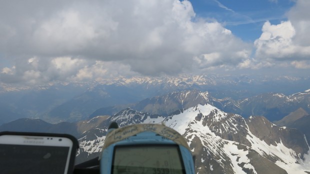
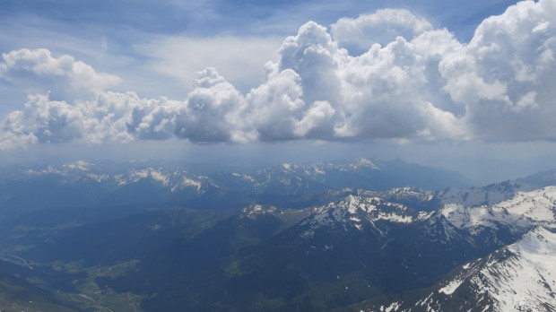
Just after launch, heading west under nice lifty clouds- note the height of 3539 meters. Not bad for 10:30!
There were maybe 3 dozen pilots on launch early the next day. We were pretty fired up to have some competent pilots in the air flying fast and showing us the route. I’d had one very short flight here last year and only knew the route by computer. But everything on launch was different than expected. What was supposed to be stable clearly wasn’t- huge Cu’s were teeing off by 0900 and we had a strong wind coming out of the north east, and we were supposed to have very light southerlies. In my mind it was still totally launch-able, but from the opposite side than normal and this seemed to dismay the locals. Everyone just sat around while the sky just kept getting better and better, even too good- it seemed if it was going ballistic this early it would OD. I was starting to get really impatient and finally Bruce could wait no longer. “Skipper, I’m going!” Thank goodness. It was clearly time to go and even with wind coming the wrong way, our only real risk was bombing out, but that seemed a very small risk with our sky.
Sure enough Bruce climbed out quickly and I followed in short order while the locals remained on the ridge. I think the sheep mentality was operating strongly. In no time we were at base at an impressive 3500 meters and shooting directly towards the first waypoint 55km’s to the west. Usually you have to make a move to the south facing main ridge off launch, but we already had such a high base there was no need. My biggest concern was the sky- several cumulus clouds were growing way too fast this early in the day and it started looking like a serious OD was almost certain.
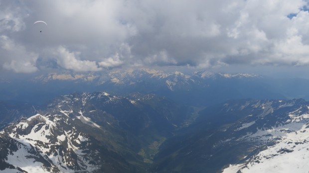
30 km’s into the flight one of the clouds we were climbing under starting spitting a little bit of hail, then some light rain. I don’t like flying in rain, especially on the IcePeak and everything to our south, towards the Dolomites was getting gray and nasty looking. Bruce and I got into serious Chatty Kathy mode. We were both nervous and clearly Plan A, a big triangle that included the Dolomites was not in the cards. And we had a lot more wind than was forecasted. 20 kilometers of South was our baseline, and at times quite a bit more. We were supposed to have less than 10. The sky to our north looked perfect. But we had no idea where to go. This option wasn’t something we’d considered and we had no idea where the mountains led. If it seriously OD’d my concern was of course rain and a gust front, and I was also concerned that if we went even deeper the winds would be worse.
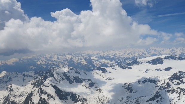
As we approached the first turn point we’d climbed to 4,000 meters without working at it. Everything was going up, and going up strongly. It wasn’t scary yet, but it was getting close. From the turnpoint the obvious route to me was just to carry on west, directly over the big mountains and fly towards Scuol. I thought I’d remembered a valley from looking at Google Earth we could follow if we just carried on about another 10 km. But below us was only solid snow and that 10km would be pretty gripping if our lift ran out. And we couldn’t see the valley, so it was a big toss of the dice.
We had to make a decision. Run west, or turn back and land, or turn back and run north. We took a couple more looks around. My hope was that the OD to the south would put a blanket on the heating and rather than rain and get nasty, it would just quiet things down. Bruce agreed so we turned back into the wind and stomped full bar and slowly made our way back towards Meran. A guy on a Sigma who must have launched around when we did took the turnpoint a little less deeply than we did and was out in front of me heading back as well. A cloud suddenly appeared just in front of him and hoovered him straight up like someone upstairs had a God-sized vacuum cleaner. He got on big ears in due order and the cloud mellowed out but that was enough for him, I watched him take big ears all the way to the ground. Time for a Red Bull.
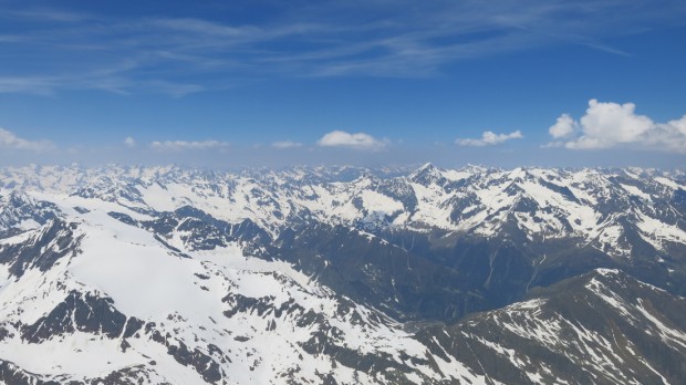
We made the glide back across Vipiteno to the main ridge system and took shelter up a smaller valley called Val de Vizze which had we just flown right up and gone over the back led right to Mayrhofen, which would have been RAD! But we didn’t know that at the time and opted instead to climb out and head north towards Innsbruck, down the east side of the Brenner pass. The OD had sufficiently eliminated all the sun in the valleys below us, but there was still plenty of lift. The flying actually went from rather sketchy to pretty enjoyable. It was still nerve-wracking watching the stuff to our south, but blue sky and acceptable cumulus clouds were all we had to the north. We just had to get there. About 110km’s into the flight we’d reached the last ridge before Innsbruck with awesome and fast flying. It was only 3 pm- all we had to do was turn right and head towards the Pinzgau and we’d maybe even make Kitzbuhel. Thankfully I had the Innsbruck airspace in my Flytec and we knew it was significant, but neither of us really knew how big. Suddenly my airspace alarm was going off and when I switched to the map page I realized we were in trouble. We had to get a huge climb and stick in the mountains, or we had to stay very close to the trees and land. We never got the climb. Bruce carried on east and I turned back west and flew right down the border of the airspace and back around to a west facing slope that had some sun on it where I hoped I could ping out but I didn’t have enough height. I walked a few kilometers, got a ride to the Autobahn tollway, then got another ride to the train station and hopped on a train to Brunico. Bruce was on the same train.
As always, with 20/20 hindsight it turns out we should have just carried on as big flights were done from Scuol and HUGE flights were done in the Pinzgau, but given what we had to work with and our lack of local knowledge, the yank and the aussie did ok today. I got 5 flights on this quick 12 day Euro trip and all of them were Chocolates (100+km, which was considerably better than the run we had in May). They were all quite a bit of work, but each had some pretty special moments. We had by a wide margin the longest flights from Speikboden, but we also talked quite a bit about risk on that train-ride home. We made the right call, but “right” could have easily been very, very wrong.
Next stop, Ashland Oregon for the Rat Race. Stay tuned.


